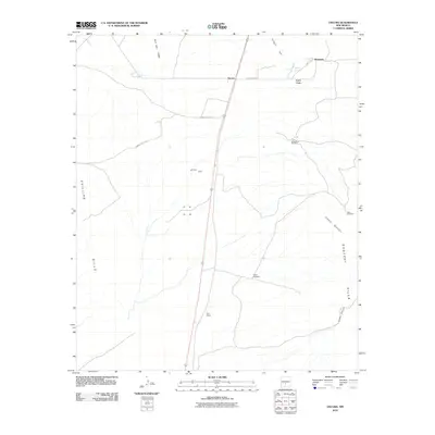
2010 Map of Oscura
USGS Topo · Published 2010About this map
Rey Mine sits near the center of this Lincoln County landscape, representative of the small-scale mineral interests that dotted the region. The high desert terrain is defined by dramatic rises such as Jackass Mountain and the Phillips Hills, where water is a precious commodity marked by scattered sites like Phillips Springs and Milagro Springs. Small settlements and named locales including Oscura, Cora Crew, and Kimmons are linked by a sparse network of roads, including WSMR S Route 313. The area's reliance on groundwater for ranching or small operations is evident through the naming of several specific water-pumping landmarks, notably the Brownstein Windmill, Taylor Windmill, and Husk Windmill. Transport infrastructure is anchored by the rail line running through North Siding, which historically facilitated the movement of goods and people through this arid stretch of New Mexico.
Find a feature on this map
19 named features on this map. Tap any name to fly to it.
Don’t see what you’re looking for? This feature index may not catch every label — zoom into the map to look around manually.
Map Details
Editions of this 2010 Oscura Map
This is the sole edition of this map. No revisions or reprints were ever made.
Other maps of this area

1916 · Tularosa
USGS Topo · 1:125,000

1918 · Oscura Peak
USGS Topo · 1:125,000

1938 · Carrizozo
USGS Topo · 1:48,000

1943 · Carrizozo
USGS Topo · 1:62,500

1947 · Three Rivers
USGS Topo · 1:62,500

1948 · Chihuahua Ranch
USGS Topo · 1:62,500

1950 · Three Rivers
USGS Topo · 1:24,000

1950 · Oscura
USGS Topo · 1:24,000

1950 · Carrizozo
USGS Topo · 1:62,500

1950 · Sierra Blanca Peak
USGS Topo · 1:62,500