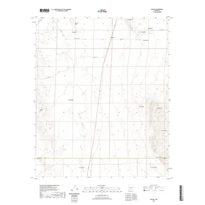
2020 Map of Oscura
USGS Topo · Published 2020About this map
Oscura and the neighboring locale of Cora Crew anchor this high-desert landscape in the Tularosa Basin, where the topography shifts from the level plains to the rising slopes of Jackass Mtn and the Godfrey Hills. The map details a network of water sources essential to this arid environment, including Milagro Springs, Keen Spring, and Phillips Springs, which dot the northern elevations near Milagro Hill. The presence of these named springs suggests a history of cattle ranching or early habitation where reliable water was the most valuable resource. Modern military and transit infrastructure is also evident, with routes like Wsmar 5 RT 312 and Wsmr S RT 313 intersecting the township lines. To the south, the county line separates Lincoln and Otero counties near the drainage of New Well Draw, while the northeastern corner shows a small grid of development around Grand Blvd near Kimmons.
Find a feature on this map
27 named features on this map. Tap any name to fly to it.
Don’t see what you’re looking for? This feature index may not catch every label — zoom into the map to look around manually.
Map Details
Editions of this 2020 Oscura Map
This is the sole edition of this map. No revisions or reprints were ever made.
Other maps of this area

1916 · Tularosa
USGS Topo · 1:125,000

1918 · Oscura Peak
USGS Topo · 1:125,000

1938 · Carrizozo
USGS Topo · 1:48,000

1943 · Carrizozo
USGS Topo · 1:62,500

1947 · Three Rivers
USGS Topo · 1:62,500

1948 · Chihuahua Ranch
USGS Topo · 1:62,500

1950 · Three Rivers
USGS Topo · 1:24,000

1950 · Oscura
USGS Topo · 1:24,000

1950 · Carrizozo
USGS Topo · 1:62,500

1950 · Sierra Blanca Peak
USGS Topo · 1:62,500