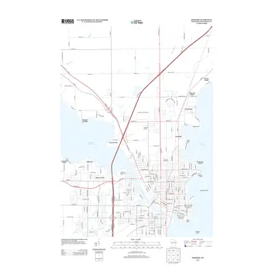
2013 Map of Oshkosh
USGS Topo · Published 2013About this map
Lake Winnebago and Lake Butte des Morts dominate this Winnebago County landscape, joined by the steady course of the Fox River. The 2013 survey illustrates the dense residential and recreational development along the shorelines, including the neighborhoods of Oakwood, Melrose Park, and Fairview Beach. Significant public and institutional footprints are visible throughout the quadrangle, notably the large Wisconsin St Prison Farm and the Winnebago Co Community Park. Along the eastern waterfront, specialized landmarks such as the Buckstaff Observatory and the Carl Schurz Monument anchor the historic municipal fabric. Navigation and aviation are represented by the Mill Street Boat Ramp and Gallinger Airport, while the intricate network of reef systems like Horseshoe Reef and Oshkosh Reefs highlights the underwater geography critical to local boaters.
Find a feature on this map
191 named features on this map. Tap any name to fly to it.
Don’t see what you’re looking for? This feature index may not catch every label — zoom into the map to look around manually.
Map Details
Editions of this 2013 Oshkosh Map
This is the sole edition of this map. No revisions or reprints were ever made.
Other maps of this area

1910 · Fond du Lac
USGS Topo · 1:62,500

1911 · Neenah
USGS Topo · 1:62,500

1955 · Neenah
USGS Topo · 1:62,500

1955 · Neenah
USGS Topo · 1:24,000

1955 · Fond Du Lac
USGS Topo · 1:62,500

1955 · Green Bay
USGS Topo · 1:250,000

1956 · Rosendale
USGS Topo · 1:62,500

1957 · Madison
USGS Topo · 1:250,000

1960 · Madison
USGS Topo · 1:250,000

1961 · Oshkosh
USGS Topo · 1:24,000