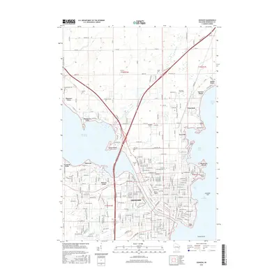
2016 Map of Oshkosh
USGS Topo · Published 2016About this map
The Fox River serves as the central artery for Oshkosh, flowing between the expanses of Lake Butte des Morts and Lake Winnebago. This modern survey documents the dense urban grid of the city, including the sprawling campus of the University of Wisconsin - Oshkosh and several major historic burial grounds such as Riverside Cem and Calvary Cem. Along the western shores of Lake Winnebago, various shoreline developments and points are identified, including Rockaway Beach, Doemel Point, and the Asylum Point area near the State Hospital Cem. The map provides a detailed view of the regional infrastructure, from the Gallinger Airport to the intricate network of suburban developments like Oakwood and Melrose Park that surround the urban core. To the north, the smaller community of Winnebago sits near North Asylum Bay, illustrating the continued importance of the lakefront to the county's settlement patterns.
Find a feature on this map
255 named features on this map. Tap any name to fly to it.
Don’t see what you’re looking for? This feature index may not catch every label — zoom into the map to look around manually.
Map Details
Editions of this 2016 Oshkosh Map
This is the sole edition of this map. No revisions or reprints were ever made.
Other maps of this area

1910 · Fond du Lac
USGS Topo · 1:62,500

1911 · Neenah
USGS Topo · 1:62,500

1955 · Neenah
USGS Topo · 1:62,500

1955 · Neenah
USGS Topo · 1:24,000

1955 · Fond Du Lac
USGS Topo · 1:62,500

1955 · Green Bay
USGS Topo · 1:250,000

1956 · Rosendale
USGS Topo · 1:62,500

1957 · Madison
USGS Topo · 1:250,000

1960 · Madison
USGS Topo · 1:250,000

1961 · Oshkosh
USGS Topo · 1:24,000