
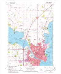
1961 Map of Oshkosh
USGS Topo · Published 1962About this map
The Fox River channel serves as the central artery for Oshkosh in the early 1960s, connecting the waters of Lake Butte des Morts and Winnebago Lake. This period captures the city's established civic and educational infrastructure, anchored by Wisconsin State College and the prominent Courthouse near Ceape Ave. The landscape reflects a specialized institutional presence north of the city center, including the Winnebago State Prison Farm, Sunny View Sanatorium, and County Hospital.
Find a feature on this map
115 named features on this map. Tap any name to fly to it.
Don’t see what you’re looking for? This feature index may not catch every label — zoom into the map to look around manually.
Map Details
Editions of this 1961 Oshkosh Map
2 editions found
Other maps of this area

1910 · Fond du Lac
USGS Topo · 1:62,500

1911 · Neenah
USGS Topo · 1:62,500

1955 · Neenah
USGS Topo · 1:62,500

1955 · Neenah
USGS Topo · 1:24,000

1955 · Fond Du Lac
USGS Topo · 1:62,500

1955 · Green Bay
USGS Topo · 1:250,000

1956 · Rosendale
USGS Topo · 1:62,500

1957 · Madison
USGS Topo · 1:250,000

1960 · Madison
USGS Topo · 1:250,000

1961 · Oshkosh
USGS Topo · 1:62,500