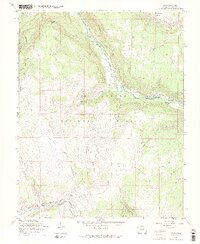
1967 Map of Osier
USGS Topo · Published 1969About this map
The Denver and Rio Grande Western railroad threads through this high-altitude landscape of southern Colorado, following the dramatic contours of the Los Pinos River canyon. Near the small outpost of Osier, the topography is defined by the massive presence of Spruce Mountain and Osier Mountain, which rise sharply above the river valleys. The 1967 survey highlights the area's role as a working forest and rangeland, evidenced by the La Manga Stock Driveway and the Trail Gulch Cow Camp. In the northern section, the Conejos River meanders near the River Springs Ranger Station and Menkhaven Ranch, while the surrounding Rio Grande National Forest is crisscrossed by pack trails and jeep paths, reflecting a mid-century period of recreation and livestock management.
Find a feature on this map
35 named features on this map. Tap any name to fly to it.
Don’t see what you’re looking for? This feature index may not catch every label — zoom into the map to look around manually.
Map Details
Editions of this 1967 Osier Map
3 editions found
Other maps of this area

1918 · Tusas
USGS Topo · 1:125,000

1922 · Conejos
USGS Topo · 1:125,000

1945 · Durango
USGS Topo · 1:250,000

1953 · Durango
USGS Topo · 1:250,000

1954 · Durango
USGS Topo · 1:250,000

1954 · Aztec
USGS Topo · 1:250,000

1955 · Brazos Peak
USGS Topo · 1:62,500

1958 · Aztec
USGS Topo · 1:250,000

1961 · Durango
USGS Topo · 1:250,000

1962 · Aztec
USGS Topo · 1:250,000