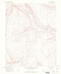
1967 Map of Osier
USGS Topo · Published 1969About this map
The Denver and Rio Grande Western narrow-gauge railroad winds through this high-altitude landscape of southern Colorado, following the difficult curves of the Toltec Creek drainage. At the center of the railway's progress sits Osier, a significant station point located at the base of Osier Mountain. The high-country economy is illustrated by seasonal locations like Trail Gulch Cow Camp and the presence of the River Springs Ranger Station within the Rio Grande National Forest.
Find a feature on this map
35 named features on this map. Tap any name to fly to it.
Don’t see what you’re looking for? This feature index may not catch every label — zoom into the map to look around manually.
Map Details
Editions of this 1967 Osier Map
3 editions found
Other maps of this area

1918 · Tusas
USGS Topo · 1:125,000

1922 · Conejos
USGS Topo · 1:125,000

1945 · Durango
USGS Topo · 1:250,000

1953 · Durango
USGS Topo · 1:250,000

1954 · Durango
USGS Topo · 1:250,000

1954 · Aztec
USGS Topo · 1:250,000

1955 · Brazos Peak
USGS Topo · 1:62,500

1958 · Aztec
USGS Topo · 1:250,000

1961 · Durango
USGS Topo · 1:250,000

1962 · Aztec
USGS Topo · 1:250,000