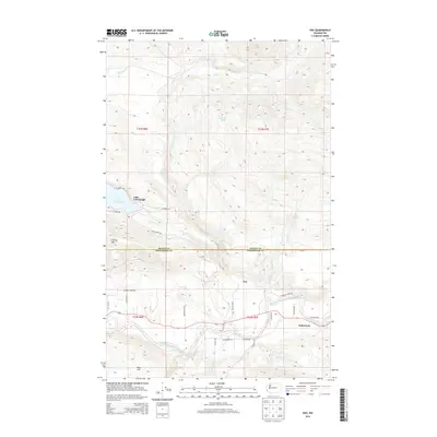
2014 Map of Oso
USGS Topo · Published 2014About this map
The North Fork Stillaguamish River defines the southern landscape of this Snohomish County survey, flowing past the communities of Oso and Halterman. The northern terrain is dominated by the waters of Lake Cavanaugh, where a network of roads including N Shore Dr and S Shore Dr service the residential development along its banks. The map provides a look at the boundary between Skagit and Snohomish counties, tracing the mountainous transition from Frailey Mtn in the west toward high-elevation water bodies like Larch Lake in the east.
Find a feature on this map
38 named features on this map. Tap any name to fly to it.
Don’t see what you’re looking for? This feature index may not catch every label — zoom into the map to look around manually.
Map Details
Editions of this 2014 Oso Map
This is the sole edition of this map. No revisions or reprints were ever made.
Other maps of this area

1899 · Stillaguamish
USGS Topo · 1:125,000

1901 · Stilaguamish
USGS Topo · 1:125,000

1911 · Mount Vernon
USGS Topo · 1:125,000

1941 · Marysville
USGS Topo · 1:62,500

1943 · Marysville
USGS Topo · 1:62,500

1944 · Clear Lake
USGS Topo · 1:62,500

1955 · Concrete
USGS Topo · 1:250,000

1956 · Arlington East
USGS Topo · 1:24,000
1956 · Clear Lake
USGS Topo · 1:62,500

1956 · Oso
USGS Topo · 1:62,500