2023 Map of Oso
USGS Topo · Published 2023About this map
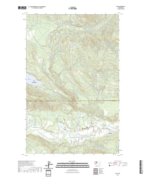
The North Fork Stillaguamish River corridor serves as the primary artery for settlement and transport in this corner of the Cascades, winding through the southern half of the quadrangle. The small community of Oso is situated at the junction where Deer Creek meets the river, historically acting as a vital point for early pioneers as evidenced by the Oso Pioneer Cem. To the east lies Halterman, another small hub along the Arlington-Darrington Rd, which follows the river's path through the valley.
Find a feature on this map
38 named features on this map. Tap any name to fly to it.
Don’t see what you’re looking for? This feature index may not catch every label — zoom into the map to look around manually.
Map Details
Editions of this 2023 Oso Map
This is the sole edition of this map. No revisions or reprints were ever made.