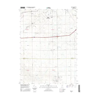
2016 Map of Ossian
USGS Topo · Published 2016About this map
Ossian serves as a southern anchor in this Northeast Indiana landscape, where the town's grid meets the headwaters of Eightmile Cr. The terrain is defined by a dense network of drainage engineering, including the Allen Mellot Ditch, Johnson Ditch, and Deptmer Ditch, which support the agricultural productivity of the Allen and Wells county line. Further north, the expansive footprint of the Fort Wayne International Airport marks the transition toward the urban perimeter of Fort Wayne.
Find a feature on this map
87 named features on this map. Tap any name to fly to it.
Don’t see what you’re looking for? This feature index may not catch every label — zoom into the map to look around manually.
Map Details
Editions of this 2016 Ossian Map
This is the sole edition of this map. No revisions or reprints were ever made.
Other maps of this area

1953 · Fort Wayne
USGS Topo · 1:250,000

1953 · Muncie
USGS Topo · 1:250,000

1955 · Markle
USGS Topo · 1:24,000

1956 · Muncie
USGS Topo · 1:250,000

1956 · Fort Wayne
USGS Topo · 1:250,000

1956 · Fort Wayne West
USGS Topo · 1:24,000

1956 · Fort Wayne East
USGS Topo · 1:24,000

1961 · Arcola
USGS Topo · 1:24,000
1961 · Zanesville
USGS Topo · 1:24,000

1962 · Poe
USGS Topo · 1:24,000