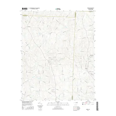
2016 Map of Ossipee
USGS Topo · Published 2016About this map
The Haw River carves through this Piedmont landscape where the boundaries of Guilford, Alamance, and Rockingham counties converge. The textile heritage of the region is reflected in the riverside settlements of Altamahaw and Ossipee, while Osceola sits further west near the headwaters of Buckhorn Lake. The map reveals a dense network of country roads named for local families and landmarks, such as Troxler Mill Rd and Gilliam Church Rd, which trace the historic migration and settlement patterns between the river valleys. Extensive water resources are documented, including Whitesell Lake Number One and Whitesell Lake Number Two, alongside several smaller creeks like Reedy Fork and Tickle Cr. This survey provides a clear view of the rural-suburban interface as it existed in the mid-2010s, capturing the enduring presence of long-established community landmarks in this corner of North Carolina.
Find a feature on this map
107 named features on this map. Tap any name to fly to it.
Don’t see what you’re looking for? This feature index may not catch every label — zoom into the map to look around manually.
Map Details
Editions of this 2016 Ossipee Map
This is the sole edition of this map. No revisions or reprints were ever made.
Other maps of this area

1951 · Browns Summit
USGS Topo · 1:24,000

1952 · Mc Leansville
USGS Topo · 1:24,000

1953 · Greensboro
USGS Topo · 1:250,000

1954 · Greensboro
USGS Topo · 1:250,000

1962 · Greensboro
USGS Topo · 1:250,000

1966 · Greensboro
USGS Topo · 1:250,000

1969 · Burlington
USGS Topo · 1:24,000

1969 · Lake Burlington
USGS Topo · 1:24,000

1970 · Gibsonville
USGS Topo · 1:24,000

1970 · Ossipee
USGS Topo · 1:24,000