1911 Map of Ostrom
USGS Topo · Published 1911About this map
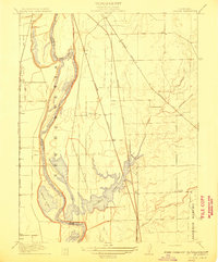
The Feather River meanders along the western edge of this 1911 survey, defining the shifting boundary between Yuba and Sutter counties through sharp turns like Eliza Bend and Shanghai Bend. This landscape is dominated by the expansive Plumas Lake and its surrounding wetlands, including Messick Lake and Abbott Lake, which drain into the river system. The presence of the Johnson Rancho land grant in the southeast corner reflects the area's deep history of large-scale land holdings dating back to the Mexican era.
Find a feature on this map
24 named features on this map. Tap any name to fly to it.
Don’t see what you’re looking for? This feature index may not catch every label — zoom into the map to look around manually.
Map Details
Editions of this 1911 Ostrom Map
This is the sole edition of this map. No revisions or reprints were ever made.
Other maps of this area

1888 · Marysville
USGS Topo · 1:125,000

1888 · Smartsville
USGS Topo · 1:125,000

1891 · Sacramento
USGS Topo · 1:125,000

1891 · Marysville
USGS Topo · 1:125,000

1891 · Smartsville
USGS Topo · 1:125,000

1892 · Sacramento
USGS Topo · 1:125,000

1892 · Smartsville
USGS Topo · 1:125,000

1893 · Sacramento
USGS Topo · 1:125,000

1894 · Smartsville
USGS Topo · 1:125,000

1894 · Marysville
USGS Topo · 1:125,000