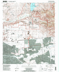
1996 Map of Otay Mesa
USGS Topo · Published 2002About this map
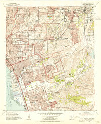
The international boundary between California and Baja California bisects this landscape, revealing a stark contrast in development patterns during the mid-1990s. To the north, the Otay Mesa plateau is characterized by large-scale infrastructure and industrial facilities, including the RJ Donovan Correctional Facility and the Brown Field Municipal Airport. The northeastern corner is dominated by the steep slopes of the San Ysidro Mountains and the protected lands of the San Diego National Wildlife Refuge. South of the border, the urban density of Tijuana spreads across the valley floor and into neighborhoods such as Chilpancingo and Murua. This map documents a critical period of binational growth, showing the Tijuana International Airport situated directly against the fence line, just south of the US Customs and Commercial Vehicle Inspection Facility that manage the region's cross-border commerce.
Find a feature on this map
56 named features on this map. Tap any name to fly to it.
Don’t see what you’re looking for? This feature index may not catch every label — zoom into the map to look around manually.
Map Details
Editions of this 1996 Otay Mesa Map
This is the sole edition of this map. No revisions or reprints were ever made.
Other maps of this area

1903 · Cuyamaca
USGS Topo · 1:125,000

1904 · San Diego
USGS Topo · 1:62,500

1904 · Southern California Sheet No. 2
USGS Topo · 1:250,000

1930 · San Diego
USGS Topo · 1:62,500
1943 · San Ysidro
USGS Topo · 1:31,680

1943 · Jamul
USGS Topo · 1:62,500
1944 · National City
USGS Topo · 1:31,680

1950 · San Diego
USGS Topo · 1:250,000
1953 · San Ysidro
USGS Topo · 1:24,000
1953 · National City
USGS Topo · 1:24,000