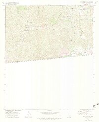
1972 Map of Otay Mountain
USGS Topo · Published 1984About this map
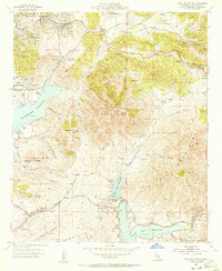
The San Ysidro Mountains dominate this rugged Southern California landscape, where the international boundary between the United States and Mexico cuts across the southern terrain. This 1970s survey captures a transition point between the upland slopes of Otay Mountain and the remote drainage systems of Cottonwood Creek and the Tijuana River. Traces of early 20th-century industry and infrastructure are preserved in the presence of the Donohoe Mine and several gaging stations along the creek beds, while the Dulzura Community Center serves as a small anchor for the sparse local population. The map's network of unpaved routes, such as the Minnewawa Truck Trail and the Otay Mtn Truck Trail, reveals a landscape managed for fire access and telecommunications, evidenced by the clusters of Radio Towers at high elevations. Water sources like Echo Spring and Lupe Spring are vital markers in this arid region, providing historical context for early ranching and mining operations in Marron Valley.
Find a feature on this map
32 named features on this map. Tap any name to fly to it.
Don’t see what you’re looking for? This feature index may not catch every label — zoom into the map to look around manually.
Map Details
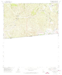
Editions of this 1972 Otay Mountain Map
3 editions found

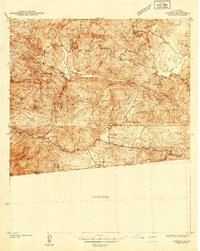
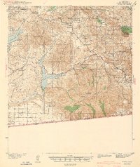
Other maps of this area

1903 · Cuyamaca
USGS Topo · 1:125,000

1904 · Southern California Sheet No. 2
USGS Topo · 1:250,000
1942 · Potrero
USGS Topo · 1:48,000
1943 · Jamul
USGS Topo · 1:62,500
1944 · Potrero
USGS Topo · 1:62,500

1950 · San Diego
USGS Topo · 1:250,000

1954 · San Diego
USGS Topo · 1:250,000

1955 · San Diego
USGS Topo · 1:250,000
1955 · Jamul Mountains
USGS Topo · 1:24,000
1955 · Otay Mesa
USGS Topo · 1:24,000