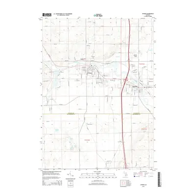
2014 Map of Otsego
USGS Topo · Published 2014About this map
Otsego and Plainwell occupy the heart of this Allegan and Kalamazoo County borderland, situated along the winding course of the Kalamazoo River. This 2014 survey illustrates the established street grids and suburban growth of these neighboring communities, which are linked by both river geography and major transit corridors. The river system is a defining feature, with the Gun River feeding in from the northeast and numerous smaller bodies such as Ruppert Lake and Barbour Lake dotting the southern landscape in Alamo Township. Local history is well-preserved through several dedicated burial grounds, including the centrally located Mtn Home Cem and Saint Margaret Cem in Otsego, alongside the Plainwell Municipal Airport situated just north of its namesake city. The survey captures the transition from dense residential blocks to the open lake country of southern Michigan.
Find a feature on this map
76 named features on this map. Tap any name to fly to it.
Don’t see what you’re looking for? This feature index may not catch every label — zoom into the map to look around manually.
Map Details
Editions of this 2014 Otsego Map
This is the sole edition of this map. No revisions or reprints were ever made.
Other maps of this area

1916 · Kalamazoo
USGS Topo · 1:62,500

1918 · Kalamazoo
USGS Topo · 1:62,500

1943 · Kalamazoo
USGS Topo · 1:62,500

1946 · Gobles
USGS Topo · 1:62,500

1948 · Gobles
USGS Topo · 1:62,500

1949 · Gobles
USGS Topo · 1:62,500

1958 · Allegan
USGS Topo · 1:62,500

1958 · Grand Rapids
USGS Topo · 1:250,000

1959 · Wayland
USGS Topo · 1:62,500

1961 · Grand Rapids
USGS Topo · 1:250,000