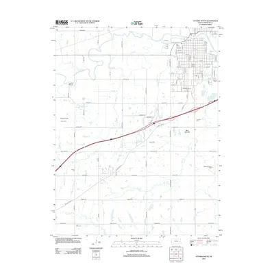
2012 Map of Ottawa South
USGS Topo · Published 2012About this map
The Marais des Cygnes River winds through the northern portion of this landscape, anchoring the city of Ottawa. The urban grid is dense with historical landmarks, including the campus of Ottawa Univ and the Ottawa Fairgrounds. Outside the city center, the terrain transitions into the Chippewa Hills and Sand Hills, where various small tributaries like Island Cr and Rock Cr drain the countryside. Genealogists will find a high density of burial sites across the quadrangle, ranging from Mount Calvary Cem and Highland Cem near the river to more remote locations like Muncie Cem and Saint John's Cem to the south. Transport infrastructure is prominent, featuring the Ottawa Municipal Airport and the rail activity at B N Junction.
Find a feature on this map
85 named features on this map. Tap any name to fly to it.
Don’t see what you’re looking for? This feature index may not catch every label — zoom into the map to look around manually.
Map Details
Editions of this 2012 Ottawa South Map
This is the sole edition of this map. No revisions or reprints were ever made.
Other maps of this area

1885 · Garnett
USGS Topo · 1:125,000

1885 · Lawrence
USGS Topo · 1:125,000

1889 · Lawrence
USGS Topo · 1:125,000

1894 · Garnett
USGS Topo · 1:125,000

1947 · Lawrence
USGS Topo · 1:250,000

1950 · Lawrence
USGS Topo · 1:250,000

1956 · Pomona
USGS Topo · 1:24,000

1956 · Ottawa North
USGS Topo · 1:24,000

1956 · Le Loup
USGS Topo · 1:24,000

1956 · Williamsburg
USGS Topo · 1:24,000