
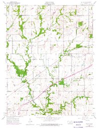
1956 Map of Le Loup
USGS Topo · Published 1957About this map
The Atchison Topeka and Santa Fe railroad corridor anchors the landscape of eastern Kansas in the mid-1950s, connecting the small settlements of Le Loup and Norwood. This survey reveals a high density of rural institutions, particularly small schools such as Brown Sch, Spring Creek Sch, and New Hope Sch, which served the farming communities across Franklin and Ottawa townships. A notable cultural marker is the Old Indian Boundary, which cuts across the central portion of the map, reflecting historical land divisions near the Indian Cem.
Find a feature on this map
34 named features on this map. Tap any name to fly to it.
Don’t see what you’re looking for? This feature index may not catch every label — zoom into the map to look around manually.
Map Details
Editions of this 1956 Le Loup Map
2 editions found
Other maps of this area

1885 · Lawrence
USGS Topo · 1:125,000

1889 · Lawrence
USGS Topo · 1:125,000

1947 · Lawrence
USGS Topo · 1:250,000

1950 · Lawrence
USGS Topo · 1:250,000

1956 · Wellsville
USGS Topo · 1:24,000

1956 · Ottawa North
USGS Topo · 1:24,000

1956 · Ottawa South
USGS Topo · 1:24,000
1956 · Edgerton
USGS Topo · 1:24,000

1956 · Lawrence
USGS Topo · 1:250,000
1957 · Lone Star
USGS Topo · 1:24,000