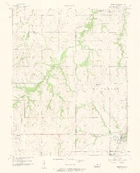
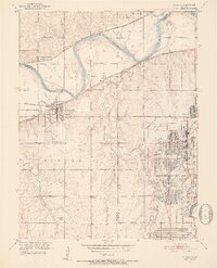
1956 Map of Edgerton
USGS Topo · Published 1958About this map
Edgerton serves as the primary hub in this mid-century survey, situated along the Santa Fe railroad line where the industrial presence of the Compressor Station and Santa Fe Lake are clearly marked. The landscape is defined by the headwaters and branches of Captain Creek and Wakarusa Creek, which cross the Douglas Co Johnson Co boundary. This area preserves the locations of several rural community centers that supported local farm families, including Clearfield and Black Jack.
Find a feature on this map
27 named features on this map. Tap any name to fly to it.
Don’t see what you’re looking for? This feature index may not catch every label — zoom into the map to look around manually.
Map Details
Editions of this 1956 Edgerton Map
3 editions found
Other maps of this area

1885 · Lawrence
USGS Topo · 1:125,000

1887 · Olathe
USGS Topo · 1:125,000

1889 · Lawrence
USGS Topo · 1:125,000

1893 · Olathe
USGS Topo · 1:125,000

1947 · Lawrence
USGS Topo · 1:250,000

1950 · Lawrence
USGS Topo · 1:250,000
1950 · Lawrence East
USGS Topo · 1:24,000

1951 · De Soto
USGS Topo · 1:24,000
1951 · Eudora
USGS Topo · 1:24,000

1956 · Wellsville
USGS Topo · 1:24,000