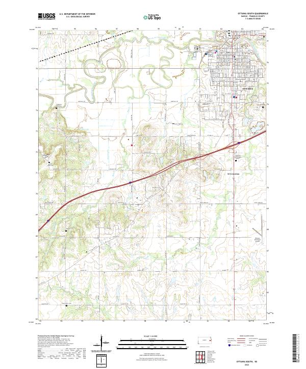
2022 Map of Ottawa South
USGS Topo · Published 2022About this map
Ottawa serves as the regional anchor on this survey, situated along the winding course of the Marais des Cygnes River. The town’s historical and institutional depth is evident through the inclusion of the Franklin County District Courthouse and the sprawling campus of Ottawa University. Beyond the street grid, the landscape transitions into the distinctive Chippewa Hills to the west and the Sand Hills to the south, reflecting a topography defined by significant tributaries like Appanoose Cr and Rock Cr. Genealogy researchers will find substantial value in the numerous burial grounds documented, ranging from the Munsee Indian Cem to Antioch Cem and Saint John's Cem. The presence of the B N Junction and the Ottawa Municipal Airport highlights the area's role as a local transportation hub for Franklin County.
Find a feature on this map
107 named features on this map. Tap any name to fly to it.
Don’t see what you’re looking for? This feature index may not catch every label — zoom into the map to look around manually.
Map Details
Editions of this 2022 Ottawa South Map
This is the sole edition of this map. No revisions or reprints were ever made.
Other maps of this area

1885 · Garnett
USGS Topo · 1:125,000

1885 · Lawrence
USGS Topo · 1:125,000

1889 · Lawrence
USGS Topo · 1:125,000

1894 · Garnett
USGS Topo · 1:125,000

1947 · Lawrence
USGS Topo · 1:250,000

1950 · Lawrence
USGS Topo · 1:250,000

1956 · Pomona
USGS Topo · 1:24,000

1956 · Ottawa North
USGS Topo · 1:24,000

1956 · Le Loup
USGS Topo · 1:24,000

1956 · Williamsburg
USGS Topo · 1:24,000