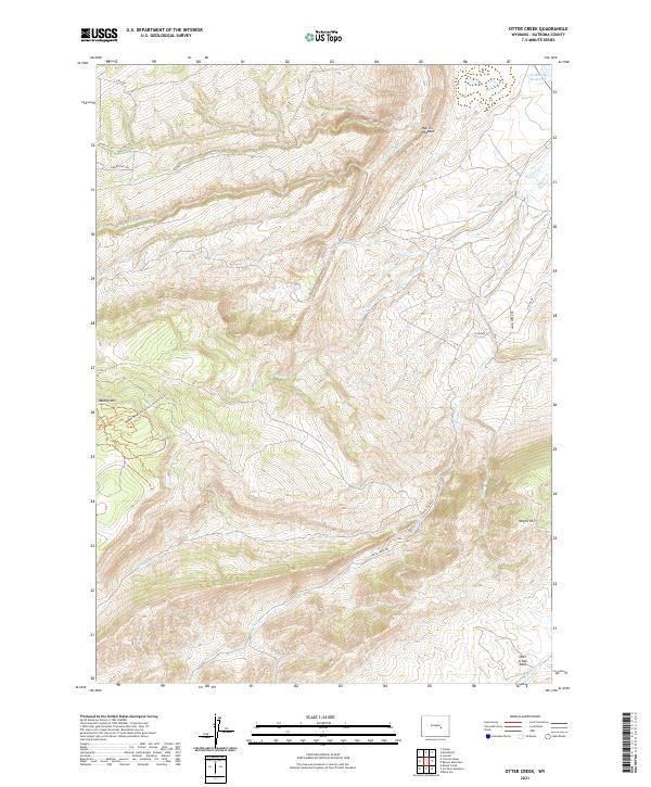
2021 Map of Otter Creek
USGS Topo · Published 2021About this map
High desert drainage patterns and the headwaters of the regional creek system define this portion of Natrona County. The topography is dominated by the complex erosional features of Clear-Fork Muddy Cr and Beaver Cr, which carve through the high plains. Human presence is marked by water management infrastructure, most notably the McDonald Reservoir in the northeastern corner, which serves as a vital water source in this arid environment. The map details the transition between various public land survey sections, illustrating how the grid system was imposed upon the winding natural watercourses that shaped early ranching and land use in this part of Wyoming.
Find a feature on this map
3 named features on this map. Tap any name to fly to it.
Don’t see what you’re looking for? This feature index may not catch every label — zoom into the map to look around manually.
Map Details
Editions of this 2021 Otter Creek Map
This is the sole edition of this map. No revisions or reprints were ever made.
Other maps of this area

1949 · Brookhurst
USGS Topo · 1:24,000

1950 · Lockett
USGS Topo · 1:24,000

1950 · Brookhurst
USGS Topo · 1:24,000

1951 · Casper
USGS Topo · 1:24,000

1955 · Casper
USGS Topo · 1:250,000

1958 · Casper
USGS Topo · 1:250,000

1960 · Crimson Dawn
USGS Topo · 1:24,000

1960 · Sheep Creek
USGS Topo · 1:24,000

1960 · Ice Cave Mountain
USGS Topo · 1:24,000

1960 · Banner Mtn
USGS Topo · 1:24,000