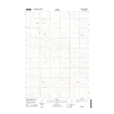
2015 Map of Ottumwa
USGS Topo · Published 2015About this map
Ottumwa serves as the focal point of this rural prairie landscape in Haakon County, anchored by its proximity to Ottumwa Lake. The settlement is defined by a grid of section-line roads, including Ottumwa Rd and the east-west 11 Mile Rd, which facilitate transit across the open terrain. The drainage patterns of the region are dominated by several seasonal waterways, most notably Mule Cr and Mitchell Cr, which wind through the land and influence the placement of early infrastructure like Ottumwa School Rd. The map illustrates a classic Great Plains land management pattern, with large townships such as t3n r23e and t2n r24e clearly delineated. This 2015 survey reflects a modern view of a sparsely populated area that has maintained its agricultural character and local place names over several generations.
Find a feature on this map
24 named features on this map. Tap any name to fly to it.
Don’t see what you’re looking for? This feature index may not catch every label — zoom into the map to look around manually.
Map Details
Editions of this 2015 Ottumwa Map
This is the sole edition of this map. No revisions or reprints were ever made.
Other maps of this area

1954 · Powell
USGS Topo · 1:24,000

1954 · Midland
USGS Topo · 1:24,000

1954 · Nowlin
USGS Topo · 1:24,000

1954 · Pierre
USGS Topo · 1:250,000

1958 · Pierre
USGS Topo · 1:250,000

1982 · Midland NW
USGS Topo · 1:24,000

1982 · May Ranch
USGS Topo · 1:24,000

1983 · Mule Creek
USGS Topo · 1:24,000

1983 · Philip
USGS Topo · 1:100,000

1983 · Powell NW
USGS Topo · 1:24,000