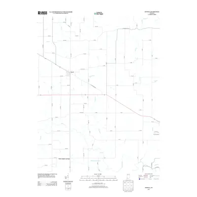
2013 Map of Otwell
USGS Topo · Published 2013About this map
Otwell serves as the central hub of this Indiana landscape, where a grid of rural county roads connects agricultural fields and winding waterways. The community is situated at the intersection of several local routes, including E Jefferson St and W Old Petersburg Rd. To the south, the settlement of White Sulphur Springs sits near the banks of Sulphur Springs Brook, reflecting the region's hydrographic character defined by numerous small streams and drainage systems. The southern boundary is marked by the meandering path of the Patoka River and its confluence with Altar Cr. The drainage patterns here, including Little Flat Cr and County Ditch, illustrate the complex relationship between the local topography and the managed agricultural lands of Pike County. To the east, Ireland Lake provides a distinct landmark amidst a network of creeks like Birch Cr and Rizzley Cr.
Find a feature on this map
68 named features on this map. Tap any name to fly to it.
Don’t see what you’re looking for? This feature index may not catch every label — zoom into the map to look around manually.
Map Details
Editions of this 2013 Otwell Map
This is the sole edition of this map. No revisions or reprints were ever made.
Other maps of this area

1902 · Ditney
USGS Topo · 1:125,000

1903 · Velpen
USGS Topo · 1:62,500

1944 · Glendale
USGS Topo · 1:24,000

1945 · Sandy Hook
USGS Topo · 1:24,000

1946 · Jasper
USGS Topo · 1:24,000

1954 · Huntingburg
USGS Topo · 1:24,000

1956 · Alfordsville
USGS Topo · 1:24,000

1956 · Vincennes
USGS Topo · 1:250,000

1957 · Vincennes
USGS Topo · 1:250,000

1958 · Vincennes
USGS Topo · 1:250,000