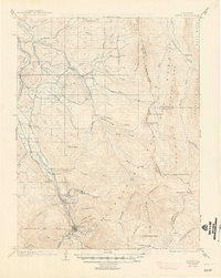
1904 Map of Ouray
USGS Topo · Published 1948About this map
Ouray sits at the heart of this early 20th-century topographic study, appearing as a concentrated hub of mountain commerce and transportation. The town is surrounded by a formidable ring of peaks, including Whitehouse Mtn. and the dramatic natural bowl of The Amphitheater. This era was defined by the reach of the narrow-gauge railroads, with the Denver and Rio Grande R.R. and the Rio Grande Southern R.R. providing essential links to the outside world through the steep valleys. North of town, smaller settlements like Bachelor Switch and Portland mark the progression of the rail lines along the Uncompahgre River. High-altitude routes such as the Horsethief Trail and features like the Hot Springs suggest a landscape where mining, early tourism, and rugged alpine transit intersected before the modernization of the high country.
Find a feature on this map
65 named features on this map. Tap any name to fly to it.
Don’t see what you’re looking for? This feature index may not catch every label — zoom into the map to look around manually.
Map Details
Editions of this 1904 Ouray Map
3 editions found
Other maps of this area

1897 · Telluride
USGS Topo · 1:62,500

1897 · Silverton
USGS Topo · 1:62,500

1901 · Silverton
USGS Topo · 1:62,500

1902 · Silverton
USGS Topo · 1:62,500

1902 · Ouray
USGS Topo · 1:62,500

1903 · Lake City
USGS Topo · 1:62,500

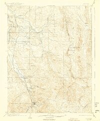
1904 · Ouray
USGS Topo · 1:62,500

1904 · Telluride
USGS Topo · 1:62,500

1905 · Lake City
USGS Topo · 1:62,500

1905 · San Cristobal
USGS Topo · 1:125,000