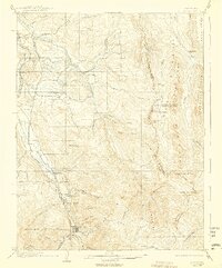
1904 Map of Ouray
USGS Topo · Published 1938About this map
Ouray sits deep in a dramatic high-altitude basin, where the Uncompahgre River meets a network of steep mountain drainages including Canyon Creek and Oak Creek. This early 20th-century landscape is defined by the heavy infrastructure of the Denver and Rio Grande RR, which follows the river valley north through Portland and Dallas. The mapping of the Uncompahgre National Forest reveals a region shaped by complex geology, from the sheer walls of The Amphitheater to the high alpine plateau of American Flat.
Find a feature on this map
60 named features on this map. Tap any name to fly to it.
Don’t see what you’re looking for? This feature index may not catch every label — zoom into the map to look around manually.
Map Details
Editions of this 1904 Ouray Map
3 editions found
Other maps of this area

1897 · Telluride
USGS Topo · 1:62,500

1897 · Silverton
USGS Topo · 1:62,500

1901 · Silverton
USGS Topo · 1:62,500

1902 · Silverton
USGS Topo · 1:62,500

1902 · Ouray
USGS Topo · 1:62,500

1903 · Lake City
USGS Topo · 1:62,500

1904 · Ouray
USGS Topo · 1:62,500

1904 · Telluride
USGS Topo · 1:62,500

1905 · Lake City
USGS Topo · 1:62,500

1905 · San Cristobal
USGS Topo · 1:125,000