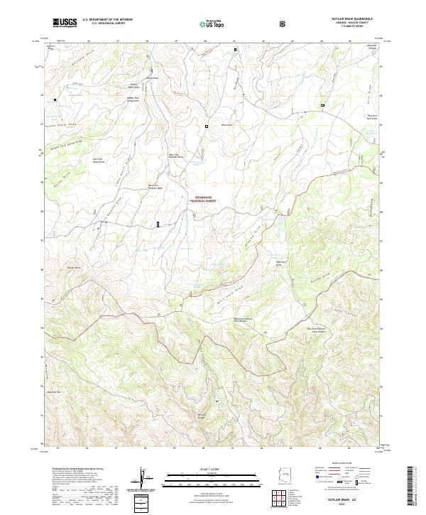
2021 Map of Outlaw Draw
USGS Topo · Published 2021About this map
Sitgreaves National Forest covers this high-altitude landscape in Navajo County, defined by the sharp transition of the Mogollon Rim and the rolling terrain of the Mogollon Plateau. The map highlights a complex drainage system including the Outlaw Draw, Whiskey Canyon, and Brahma Draw, which carved out deep channels like Foot Canyon. This area is historically significant for its transit routes, most notably the General Crook Trl, which winds across the plateau along with the 7th Heaven Trl and Ross Draw Trl.
Find a feature on this map
56 named features on this map. Tap any name to fly to it.
Don’t see what you’re looking for? This feature index may not catch every label — zoom into the map to look around manually.
Map Details
Editions of this 2021 Outlaw Draw Map
This is the sole edition of this map. No revisions or reprints were ever made.
Other maps of this area

1886 · Holbrook
USGS Topo · 1:250,000

1893 · Holbrook
USGS Topo · 1:250,000

1954 · Holbrook
USGS Topo · 1:250,000

1957 · Holbrook
USGS Topo · 1:250,000

1958 · Holbrook
USGS Topo · 1:250,000

1960 · Holbrook
USGS Topo · 1:250,000

1961 · Clay Springs
USGS Topo · 1:62,500

1961 · Heber
USGS Topo · 1:62,500

1961 · Cibecue
USGS Topo · 1:62,500

1961 · Chediski Peak
USGS Topo · 1:62,500