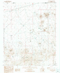
1990 Map of Outlaw Hill
USGS Topo · Published 1990About this map
Aguila Valley dominates the northern expanse of this Arizona terrain, where a landscape of mining and water management reflects the demands of the arid environment. The southern portion is defined by the Vulture Mountains, a rugged area peppered with industrial sites including the Sunrise Mine, the Lucky Cuss Mine, and various unnamed Mine Shafts and Quartz Prospects. This concentration of extraction points suggests a period of significant mineral exploration within the hills around Outlaw Hill.
Find a feature on this map
32 named features on this map. Tap any name to fly to it.
Don’t see what you’re looking for? This feature index may not catch every label — zoom into the map to look around manually.
Map Details
Editions of this 1990 Outlaw Hill Map
This is the sole edition of this map. No revisions or reprints were ever made.
Other maps of this area

1887 · Prescott
USGS Topo · 1:250,000

1892 · Prescott
USGS Topo · 1:250,000

1903 · Congress
USGS Topo · 1:125,000

1904 · Congress
USGS Topo · 1:125,000

1923 · Signal
USGS Topo · 1:250,000

1942 · Signal
USGS Topo · 1:250,000

1942 · Vicksburg
USGS Topo · 1:250,000

1950 · Prescott
USGS Topo · 1:250,000

1954 · Prescott
USGS Topo · 1:250,000

1954 · Phoenix
USGS Topo · 1:250,000