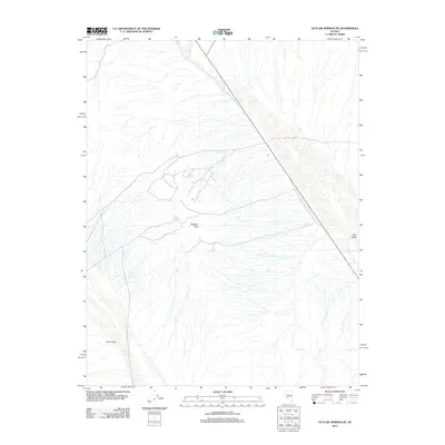
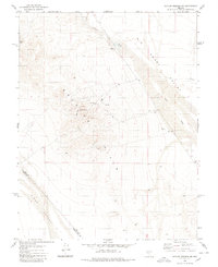
2012 Map of Outlaw Springs NE
USGS Topo · Published 2012About this map
Royston Hills dominates the central portion of this Nye County landscape, rising between two distinct desert basins. The alluvial fans of the Cirac Valley to the southwest and the Ione Valley to the northeast are etched with complex drainage patterns that converge toward ephemeral watercourses like Cloverdale Creek. This 2012 survey by the U. S. Geological Survey reflects the modern arid character of the region, where the primary infrastructure consists of a singular diagonal road corridor cutting across the northern basins. The intricate contouring reveals the subtle topographic transitions between the elevated hills and the broad valley floors, providing a clear picture of the natural water distribution in this high-desert environment.
Find a feature on this map
4 named features on this map. Tap any name to fly to it.
Don’t see what you’re looking for? This feature index may not catch every label — zoom into the map to look around manually.
Map Details
Editions of this 2012 Outlaw Springs NE Map
This is the sole edition of this map. No revisions or reprints were ever made.
Other maps of this area

1907 · Tonopah
USGS Topo · 1:250,000

1908 · Tonopah
USGS Topo · 1:250,000

1956 · Tonopah
USGS Topo · 1:250,000

1959 · Tonopah
USGS Topo · 1:250,000

1962 · Tonopah
USGS Topo · 1:250,000
1964 · San Antonio Ranch
USGS Topo · 1:62,500

1980 · Cole Spring
USGS Topo · 1:24,000
1980 · Cloverdale Ranch
USGS Topo · 1:24,000
1980 · Outlaw Springs SE
USGS Topo · 1:24,000
1980 · Outlaw Springs NE
USGS Topo · 1:24,000