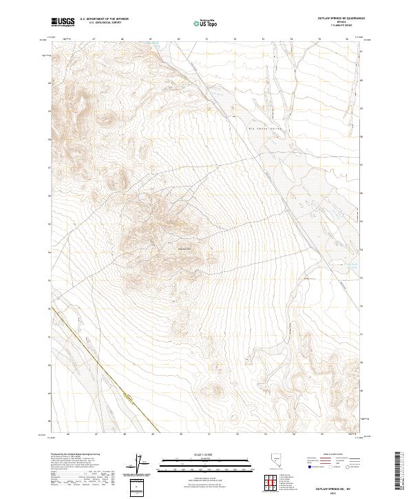
2021 Map of Outlaw Springs NE
USGS Topo · Published 2021About this map
Royston Hills rise as a prominent topographic anchor in this high-desert landscape of central Nevada, situated along the border of Nye and Esmeralda counties. The terrain is characterized by the wide drainage of Ione Wash, which cuts across the northeast and southeast sectors of the quadrangle, flowing toward the expansive Big Smoky Valley. This region is defined by its isolation and the stark contrast between the elevated mountain peaks and the broad, alluvial plains. The presence of Poleline Rd suggests a network of utility infrastructure and remote desert access corridors, providing a rare traversable path through the otherwise trackless terrain. These features together illustrate a classic Great Basin environment where seasonal water flow and mineral-rich hills dictated the sparse human movement across the valley floor.
Find a feature on this map
9 named features on this map. Tap any name to fly to it.
Don’t see what you’re looking for? This feature index may not catch every label — zoom into the map to look around manually.
Map Details
Editions of this 2021 Outlaw Springs NE Map
This is the sole edition of this map. No revisions or reprints were ever made.
Other maps of this area

1907 · Tonopah
USGS Topo · 1:250,000

1908 · Tonopah
USGS Topo · 1:250,000

1956 · Tonopah
USGS Topo · 1:250,000

1959 · Tonopah
USGS Topo · 1:250,000

1962 · Tonopah
USGS Topo · 1:250,000

1964 · San Antonio Ranch
USGS Topo · 1:62,500

1980 · Cole Spring
USGS Topo · 1:24,000
1980 · Cloverdale Ranch
USGS Topo · 1:24,000
1980 · Outlaw Springs SE
USGS Topo · 1:24,000
1980 · Outlaw Springs NE
USGS Topo · 1:24,000