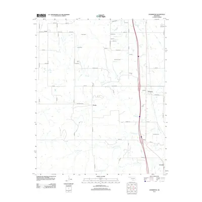
2012 Map of Overbrook
USGS Topo · Published 2012About this map
Criner Hills rise across this section of southern Oklahoma, defining the rugged landscape between the small settlements of Brock and Marsden. This 2012 survey illustrates a region where local industry and ancestral roots remain deeply intertwined with the land. The presence of the Brock Oil Field, Overbrook Oil Field, and Greenville Oil Field indicates a persistent reliance on energy production throughout the early 21st century. For genealogists and local historians, the placement of Criner Cem and McAlester Cem provides essential landmarks for family research. The drainage patterns of Hickory Cr and its various branches, including Spring Br and S Br Hickory Cr, cut through the terrain, influencing the layout of local roads like Sorghum Center Rd and Crinnerville Rd.
Find a feature on this map
63 named features on this map. Tap any name to fly to it.
Don’t see what you’re looking for? This feature index may not catch every label — zoom into the map to look around manually.
Map Details
Editions of this 2012 Overbrook Map
This is the sole edition of this map. No revisions or reprints were ever made.
Other maps of this area

1901 · Ardmore
USGS Topo · 1:125,000

1902 · Gainesville
USGS Topo · 1:125,000

1918 · Ardmore
USGS Topo · 1:125,000

1943 · Gainesville
USGS Topo · 1:125,000

1954 · Sherman
USGS Topo · 1:250,000

1957 · Ardmore
USGS Topo · 1:250,000

1958 · Sherman
USGS Topo · 1:250,000

1963 · Ardmore
USGS Topo · 1:250,000

1964 · Lake Murray
USGS Topo · 1:24,000

1964 · Ardmore East
USGS Topo · 1:24,000