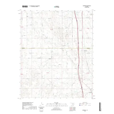
2018 Map of Overbrook
USGS Topo · Published 2018About this map
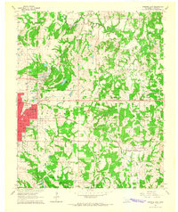
Criner Hills rise through the central portion of this Oklahoma survey, defining the rugged geography that separates the settlements of Marsden and Overbrook. This region on the Carter Co Love Co line is characterized by a network of drainage creeks and small family cemeteries, including Criner Cem, McAlester Cem, and Gordon Cem, providing essential points of interest for genealogical research. The landscape is a mix of agricultural operations like Gores Angus Farms and rural road networks that follow the section lines of the Public Land Survey System. The eastern corridor is dominated by the modern transportation artery of Interstate 35, which runs parallel to the headwaters of Hickory Cr and Little Hickory Cr. Further south, the small community of Greenville sits near the base of Hickman Hill, where the terrain begins to level out toward the southern border of the quadrangle.
Find a feature on this map
97 named features on this map. Tap any name to fly to it.
Don’t see what you’re looking for? This feature index may not catch every label — zoom into the map to look around manually.
Map Details
Editions of this 2018 Overbrook Map
This is the sole edition of this map. No revisions or reprints were ever made.
Other maps of this area
1901 · Ardmore
USGS Topo · 1:125,000
1902 · Gainesville
USGS Topo · 1:125,000
1918 · Ardmore
USGS Topo · 1:125,000
1943 · Gainesville
USGS Topo · 1:125,000

1954 · Sherman
USGS Topo · 1:250,000
1957 · Ardmore
USGS Topo · 1:250,000

1958 · Sherman
USGS Topo · 1:250,000
1963 · Ardmore
USGS Topo · 1:250,000
1964 · Lake Murray
USGS Topo · 1:24,000
1964 · Ardmore East
USGS Topo · 1:24,000