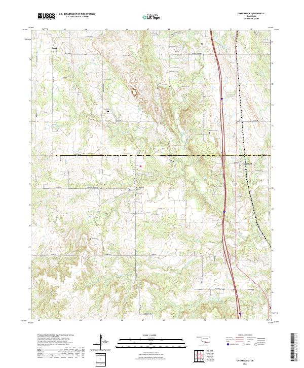
2022 Map of Overbrook
USGS Topo · Published 2022About this map
The Criner Hills rise above the rural landscapes of Love and Carter Counties, marking a transition between Oklahoma's agricultural plains and its rolling creek valleys. The settlement of Overbrook sits along the eastern rail and highway corridor, serving as a focal point for the surrounding ranching and farming operations like Gores Angus Farms. This area preserves several family and community landmarks, including the Criner Cem and McAlester Cem, which provide essential points of reference for local genealogical research. Waterways define the local topography, with Hickory Cr and its tributaries, such as Spring Br and Little Hickory Cr, carving paths through the terrain near the small communities of Marsden and Brock. The network of section line roads, including Sorghum Center RD and Dolese RD, illustrates the persistent grid-based land organization of the region.
Find a feature on this map
64 named features on this map. Tap any name to fly to it.
Don’t see what you’re looking for? This feature index may not catch every label — zoom into the map to look around manually.
Map Details
Editions of this 2022 Overbrook Map
This is the sole edition of this map. No revisions or reprints were ever made.
Other maps of this area

1901 · Ardmore
USGS Topo · 1:125,000

1902 · Gainesville
USGS Topo · 1:125,000

1918 · Ardmore
USGS Topo · 1:125,000

1943 · Gainesville
USGS Topo · 1:125,000

1954 · Sherman
USGS Topo · 1:250,000

1957 · Ardmore
USGS Topo · 1:250,000

1958 · Sherman
USGS Topo · 1:250,000

1963 · Ardmore
USGS Topo · 1:250,000

1964 · Lake Murray
USGS Topo · 1:24,000

1964 · Ardmore East
USGS Topo · 1:24,000