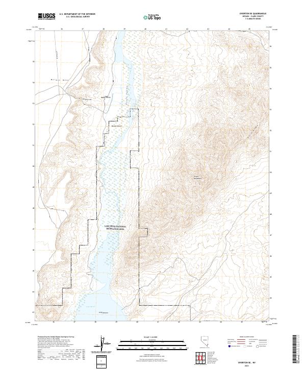
2021 Map of Overton SE
USGS Topo · Published 2021About this map
The Virgin River carves a path through this corner of the Mojave Desert, leading into the northern reaches of Lake Mead. This arid landscape is defined by its dramatic elevation changes, where the flat expanse of Mormon Mesa and Badger Bench transitions into the steep slopes of the Virgin Mountains and Black Ridge. Much of the southern and central portion of the map is protected within the Lake Mead National Recreation Area, showing the intersection of river hydrology and desert topography. Significant landmarks like Huntsman Hill and the southern basin at Long Bottom provide reference points in a region primarily accessed by rugged paths such as Carp Elgin Rd. The map illustrates the contemporary boundary of the Virgin Valley before the river fully merges with the reservoir.
Find a feature on this map
16 named features on this map. Tap any name to fly to it.
Don’t see what you’re looking for? This feature index may not catch every label — zoom into the map to look around manually.
Map Details
Editions of this 2021 Overton SE Map
This is the sole edition of this map. No revisions or reprints were ever made.
Other maps of this area

1886 · Saint Thomas
USGS Topo · 1:250,000

1893 · Saint Thomas
USGS Topo · 1:250,000

1926 · Bonelli
USGS Topo · 1:96,000

1953 · Overton Beach
USGS Topo · 1:62,500

1953 · Gold Butte
USGS Topo · 1:62,500

1954 · Las Vegas
USGS Topo · 1:250,000

1957 · Las Vegas
USGS Topo · 1:250,000

1958 · Virgin Peak
USGS Topo · 1:62,500

1958 · Overton
USGS Topo · 1:62,500

1959 · Las Vegas
USGS Topo · 1:250,000