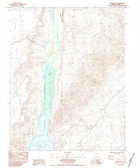
1983 Map of Overton SE
USGS Topo · Published 1984About this map
The Virgin River carves a path through the arid basin of southern Nevada, where its waters flow south into the northern reaches of Lake Mead. This 1983 provisional survey highlights the significant footprint of the Lake Mead National Recreation Area and the Overton Wildlife Management Area, marking a landscape dedicated to conservation and public use. To the west, the flat-topped Mormon Mesa overlooks the river valley, while the eastern heights are marked by several unnamed Prospects, suggesting historical mineral exploration in the desert hills. The survey identifies the Little Virgin Cairn as a localized landmark, providing a detailed look at the interface between the river's riparian corridor and the surrounding high desert plateaus.
Find a feature on this map
8 named features on this map. Tap any name to fly to it.
Don’t see what you’re looking for? This feature index may not catch every label — zoom into the map to look around manually.
Map Details
Editions of this 1983 Overton SE Map
This is the sole edition of this map. No revisions or reprints were ever made.
Other maps of this area

1886 · Saint Thomas
USGS Topo · 1:250,000

1893 · Saint Thomas
USGS Topo · 1:250,000

1926 · Bonelli
USGS Topo · 1:96,000

1953 · Overton Beach
USGS Topo · 1:62,500

1953 · Gold Butte
USGS Topo · 1:62,500

1954 · Las Vegas
USGS Topo · 1:250,000

1957 · Las Vegas
USGS Topo · 1:250,000

1958 · Virgin Peak
USGS Topo · 1:62,500

1958 · Overton
USGS Topo · 1:62,500

1959 · Las Vegas
USGS Topo · 1:250,000