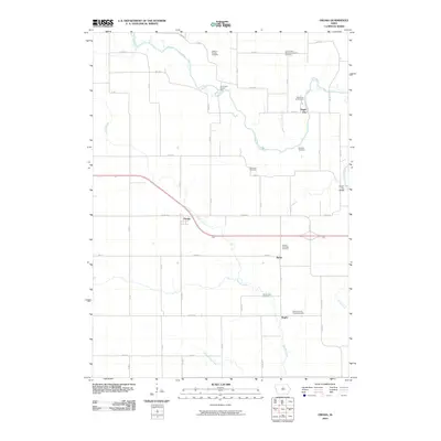
2010 Map of Owasa
USGS Topo · Published 2010About this map
Eagle City and Owasa anchor this rural landscape in north-central Iowa, where the winding path of the Iowa River cuts through a grid of agricultural section lines. The settlement patterns here are defined by small clusters like Berlin and the crossroads at Hughs, connected by a network of county roads including Co Rd D35 and Co Rd S45. The map reveals a dense concentration of local burial grounds that offer significant value for genealogical research, ranging from the Hardin City Cemetery and Hardin County Home Cemetery in the south to the North Lawn Memory Gardens Cemetery and Jackson Heights Cemetery near the northern border.
Find a feature on this map
41 named features on this map. Tap any name to fly to it.
Don’t see what you’re looking for? This feature index may not catch every label — zoom into the map to look around manually.
Map Details
Editions of this 2010 Owasa Map
This is the sole edition of this map. No revisions or reprints were ever made.
Other maps of this area

1954 · Waterloo
USGS Topo · 1:250,000

1955 · Waterloo
USGS Topo · 1:250,000

1979 · Iowa Falls West
USGS Topo · 1:24,000

1979 · Buckeye East
USGS Topo · 1:24,000

1979 · Ackley
USGS Topo · 1:24,000

1979 · Steamboat Rock
USGS Topo · 1:24,000

1979 · New Providence
USGS Topo · 1:24,000

1979 · Iowa Falls East
USGS Topo · 1:24,000

1979 · Hubbard
USGS Topo · 1:24,000

1979 · Eldora
USGS Topo · 1:24,000