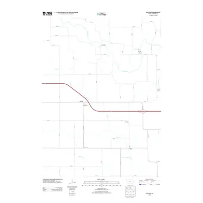
2013 Map of Owasa
USGS Topo · Published 2013About this map
The Iowa River meanders through the northeast corner of this Hardin County landscape, creating a distinct riparian corridor contrasted by the rigid section-line road grid that defines the surrounding prairie. This network of rural routes, including Railroad Ave and S Ave, connects several small settlements and points of interest. The village of Owasa sits at the intersection of Co Hwy-S45 and 185th St, while further east, the small communities of Eagle City and Berlin are situated near the banks of the river and its tributaries.
Find a feature on this map
40 named features on this map. Tap any name to fly to it.
Don’t see what you’re looking for? This feature index may not catch every label — zoom into the map to look around manually.
Map Details
Editions of this 2013 Owasa Map
This is the sole edition of this map. No revisions or reprints were ever made.
Other maps of this area

1954 · Waterloo
USGS Topo · 1:250,000

1955 · Waterloo
USGS Topo · 1:250,000

1979 · Iowa Falls West
USGS Topo · 1:24,000

1979 · Buckeye East
USGS Topo · 1:24,000

1979 · Ackley
USGS Topo · 1:24,000

1979 · Steamboat Rock
USGS Topo · 1:24,000

1979 · New Providence
USGS Topo · 1:24,000

1979 · Iowa Falls East
USGS Topo · 1:24,000

1979 · Hubbard
USGS Topo · 1:24,000

1979 · Eldora
USGS Topo · 1:24,000