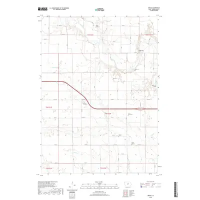
2018 Map of Owasa
USGS Topo · Published 2018About this map
Owasa sits as a central hub in this Hardin County landscape, where the agricultural grid is interrupted by the meandering course of the Iowa River. The river valley creates a distinct break in the township sections, particularly near Eagle City, where the terrain drops into more complex drainage systems involving Beaver Cr and Otter Cr. This 2018 survey reveals a territory marked by numerous community burial sites, suggesting a deep-rooted lineage of local family farms and early townships.
Find a feature on this map
37 named features on this map. Tap any name to fly to it.
Don’t see what you’re looking for? This feature index may not catch every label — zoom into the map to look around manually.
Map Details
Editions of this 2018 Owasa Map
This is the sole edition of this map. No revisions or reprints were ever made.
Other maps of this area

1954 · Waterloo
USGS Topo · 1:250,000

1955 · Waterloo
USGS Topo · 1:250,000

1979 · Iowa Falls West
USGS Topo · 1:24,000

1979 · Buckeye East
USGS Topo · 1:24,000

1979 · Ackley
USGS Topo · 1:24,000

1979 · Steamboat Rock
USGS Topo · 1:24,000

1979 · New Providence
USGS Topo · 1:24,000

1979 · Iowa Falls East
USGS Topo · 1:24,000

1979 · Hubbard
USGS Topo · 1:24,000

1979 · Eldora
USGS Topo · 1:24,000