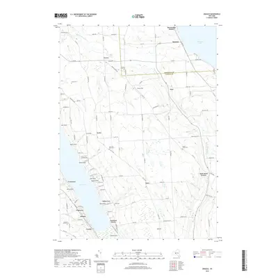
2019 Map of Owasco
USGS Topo · Published 2019About this map
Owasco Lake and Skaneateles Lake frame this central New York landscape, where the plateau between the water bodies is deeply incised by the drainage of Dutch Hollow Brook. The settlement of Owasco serves as a northern anchor, while the rural interior is dotted with small hamlets such as Niles, Austin, and Omro. This area preserves a high density of burial grounds, including the Owasco Rural Cem and the Humphrey-Howland Cem, which offer significant value for genealogical research in Cayuga and Onondaga Counties.
Find a feature on this map
90 named features on this map. Tap any name to fly to it.
Don’t see what you’re looking for? This feature index may not catch every label — zoom into the map to look around manually.
Map Details
Editions of this 2019 Owasco Map
This is the sole edition of this map. No revisions or reprints were ever made.
Other maps of this area

1898 · Moravia
USGS Topo · 1:62,500

1899 · Auburn
USGS Topo · 1:62,500

1899 · Skaneateles
USGS Topo · 1:62,500

1902 · Skaneateles
USGS Topo · 1:62,500

1902 · Moravia
USGS Topo · 1:62,500

1902 · Genoa
USGS Topo · 1:62,500

1902 · Auburn
USGS Topo · 1:62,500

1942 · Genoa
USGS Topo · 1:24,000

1943 · Moravia
USGS Topo · 1:31,680
1943 · Genoa
USGS Topo · 1:31,680