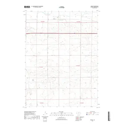
2017 Map of Owasco
USGS Topo · Published 2017About this map
Owasco sits at the northern edge of this Kimball County landscape, where the agricultural plains are defined by the winding course of Lodgepole Cr. The irrigation infrastructure essential to this High Plains region is represented by the Bennett Canal, which parallels the creek to support local farming operations. To the south, the terrain transitions into a series of drainages, most notably the wide path of Sand Draw, illustrating the natural runoff patterns that have shaped the Nebraska panhandle. A systematic grid of section lines and county roads, including Scott Rd and Co Rd 49, organizes the territory into the large-scale ranching and farming tracts characteristic of the early 21st century. This survey provides a clear view of the rural intersection between water management and transportation in a sparsely populated corner of the state.
Find a feature on this map
21 named features on this map. Tap any name to fly to it.
Don’t see what you’re looking for? This feature index may not catch every label — zoom into the map to look around manually.
Map Details
Editions of this 2017 Owasco Map
This is the sole edition of this map. No revisions or reprints were ever made.
Other maps of this area

1954 · Scottsbluff
USGS Topo · 1:250,000

1958 · Scottsbluff
USGS Topo · 1:250,000

1972 · Potter SW
USGS Topo · 1:24,000

1972 · Dix
USGS Topo · 1:24,000

1972 · Owasco
USGS Topo · 1:24,000

1972 · Kimball SE
USGS Topo · 1:24,000

1972 · Kimball SW
USGS Topo · 1:24,000

1972 · Kimball
USGS Topo · 1:24,000

1973 · Potter 2 SW
USGS Topo · 1:24,000

1973 · Kimball 1 SE
USGS Topo · 1:24,000