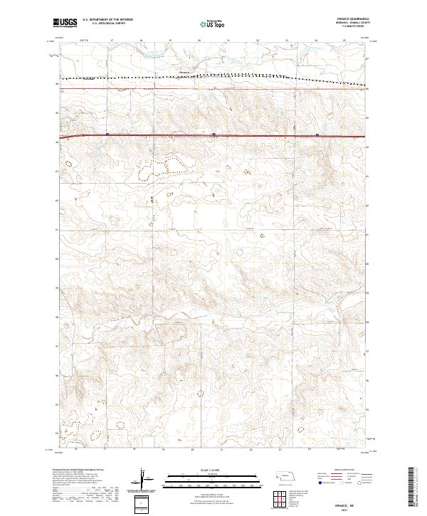
2021 Map of Owasco
USGS Topo · Published 2021About this map
Lodgepole Cr winds across the northern sections of this Kimball County landscape, accompanied by the irrigation works of the Bennett Canal. The settlement of Owasco serves as a central point in this agricultural corridor, situated along the east-west transit route of Scott Rd. To the west, the outskirts of Kimball appear, marking the transition from the town center to the surrounding rural sections. The terrain is defined by the significant drainage of Sand Draw, which cuts through the southern townships, illustrating the natural water management of the high plains. A grid of county roads, including Co RD 49 and Co RD 55, provides a framework for the vast farming and ranching operations that have long characterized the Nebraska panhandle.
Find a feature on this map
22 named features on this map. Tap any name to fly to it.
Don’t see what you’re looking for? This feature index may not catch every label — zoom into the map to look around manually.
Map Details
Editions of this 2021 Owasco Map
This is the sole edition of this map. No revisions or reprints were ever made.
Other maps of this area

1954 · Scottsbluff
USGS Topo · 1:250,000

1958 · Scottsbluff
USGS Topo · 1:250,000

1972 · Potter SW
USGS Topo · 1:24,000

1972 · Dix
USGS Topo · 1:24,000

1972 · Owasco
USGS Topo · 1:24,000

1972 · Kimball SE
USGS Topo · 1:24,000

1972 · Kimball SW
USGS Topo · 1:24,000

1972 · Kimball
USGS Topo · 1:24,000

1973 · Potter 2 SW
USGS Topo · 1:24,000

1973 · Kimball 1 SE
USGS Topo · 1:24,000