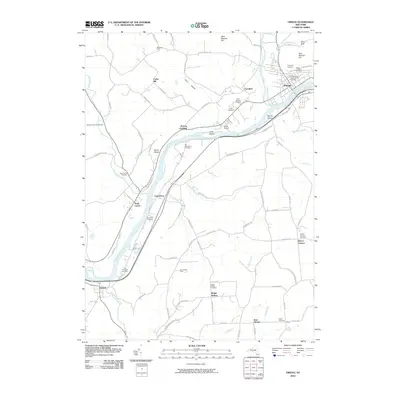
2010 Map of Owego
USGS Topo · Published 2010About this map
The Susquehanna River carves a sweeping path through this landscape, defining the character of the valley between Owego and Nichols. In the northern reaches, Owego Creek feeds into the main river, passing through a cluster of civic and spiritual history marked by Evergreen Cemetery, Saint Joseph's Cemetery, and the Presbyterian Union Church Cemetery. The topography rises sharply away from the water, reaching heights at East Beecher Hill and West Beecher Hill. Settlement patterns follow the riverbanks and tributary valleys like Thorn Hollow, where local agriculture is represented by Wildrose Farm and Sunnyside Farm. A significant concentration of burial sites, including the Old Riverside Cemetery and Tioga Center Cemetery, suggests deep ancestral roots throughout the valley. Modern infrastructure like the Tioga Airport and numerous rural roads, such as Glen Mary Dr and Catlin Hill Rd, link these scattered riverside communities.
Find a feature on this map
87 named features on this map. Tap any name to fly to it.
Don’t see what you’re looking for? This feature index may not catch every label — zoom into the map to look around manually.
Map Details
Editions of this 2010 Owego Map
This is the sole edition of this map. No revisions or reprints were ever made.
Other maps of this area

1901 · Apalachin
USGS Topo · 1:62,500

1903 · Owego
USGS Topo · 1:62,500

1904 · Apalachin
USGS Topo · 1:62,500

1906 · Catatonk
USGS Topo · 1:125,000

1923 · Towanda
USGS Topo · 1:62,500

1926 · Towanda
USGS Topo · 1:62,500

1943 · Towanda
USGS Topo · 1:62,500

1943 · Le Raysville
USGS Topo · 1:62,500

1945 · Le Raysville
USGS Topo · 1:62,500

1950 · Elmira
USGS Topo · 1:250,000