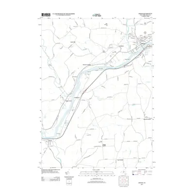
2013 Map of Owego
USGS Topo · Published 2013About this map
The Susquehanna River carves a winding path through the heart of Tioga County, defining the agricultural and residential development of Owego and its surrounding hamlets. The village of Owego serves as a dense core at the confluence with Owego Cr, where a complex street grid includes historic corridors like Front St and Main St. Moving downstream, the river passes through the dramatic bend at Devils Elbow and the narrows near Tuffs Island.
Find a feature on this map
149 named features on this map. Tap any name to fly to it.
Don’t see what you’re looking for? This feature index may not catch every label — zoom into the map to look around manually.
Map Details
Editions of this 2013 Owego Map
This is the sole edition of this map. No revisions or reprints were ever made.
Other maps of this area

1901 · Apalachin
USGS Topo · 1:62,500

1903 · Owego
USGS Topo · 1:62,500

1904 · Apalachin
USGS Topo · 1:62,500

1906 · Catatonk
USGS Topo · 1:125,000

1923 · Towanda
USGS Topo · 1:62,500

1926 · Towanda
USGS Topo · 1:62,500

1943 · Towanda
USGS Topo · 1:62,500

1943 · Le Raysville
USGS Topo · 1:62,500

1945 · Le Raysville
USGS Topo · 1:62,500

1950 · Elmira
USGS Topo · 1:250,000