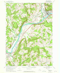
1969 Map of Owego
USGS Topo · Published 1971About this map
The Susquehanna River carves a deep valley through Tioga County, defining the industrial and social layout of Owego and the surrounding river towns. In the late 1960s, the twin corridors of the Erie Lackawanna and Lehigh Valley railroads parallel the water, serving the riverside settlements of Lounsberry and Tioga Center. The map reveals the era's transport infrastructure, including the Landing Strip and the winding Valley Road, which hugs the northern bank near the dramatic river bend at Devils Elbow.
Find a feature on this map
78 named features on this map. Tap any name to fly to it.
Don’t see what you’re looking for? This feature index may not catch every label — zoom into the map to look around manually.
Map Details
Editions of this 1969 Owego Map
2 editions found
Other maps of this area

1901 · Apalachin
USGS Topo · 1:62,500

1903 · Owego
USGS Topo · 1:62,500

1904 · Apalachin
USGS Topo · 1:62,500

1906 · Catatonk
USGS Topo · 1:125,000

1923 · Towanda
USGS Topo · 1:62,500

1926 · Towanda
USGS Topo · 1:62,500

1943 · Towanda
USGS Topo · 1:62,500

1943 · Le Raysville
USGS Topo · 1:62,500

1945 · Le Raysville
USGS Topo · 1:62,500

1950 · Elmira
USGS Topo · 1:250,000