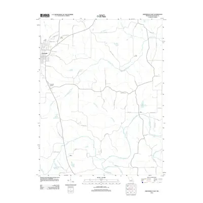
2012 Map of Owensville East
USGS Topo · Published 2012About this map
Owensville serves as the primary hub in this Gasconade County landscape, situated near the western edge of the survey area. The terrain is defined by a dense network of tributaries including Red Oak Creek, Block Branch, and Dry Fork, which all contribute to the south-flowing Bourbeuse River. The map reveals a high concentration of burial sites, such as Leach Cemetery and Salem Cemetery, providing significant data points for genealogists tracking early family settlements across the region. Small rural centers like Bem and Tea anchor the southern and eastern quadrants, respectively. The presence of specialized water features like Tea Lake and the Arno Kreter Lake suggests a mix of natural drainage and engineered reservoirs. This 2012 layout preserves a clear view of the county's road network, from established routes like the Bohemian Hwy to more localized family-named lanes like Niewald Rd and Hafertafe Rd.
Find a feature on this map
62 named features on this map. Tap any name to fly to it.
Don’t see what you’re looking for? This feature index may not catch every label — zoom into the map to look around manually.
Map Details
Editions of this 2012 Owensville East Map
This is the sole edition of this map. No revisions or reprints were ever made.
Other maps of this area

1903 · Sullivan
USGS Topo · 1:125,000

1934 · Bland
USGS Topo · 1:62,500

1934 · Redbird
USGS Topo · 1:62,500

1935 · Gerald
USGS Topo · 1:48,000

1937 · Bland
USGS Topo · 1:62,500

1938 · Redbird
USGS Topo · 1:62,500

1941 · Gerald
USGS Topo · 1:62,500

1944 · Gerald
USGS Topo · 1:62,500

1948 · Argo
USGS Topo · 1:24,000

1948 · Oak Hill
USGS Topo · 1:24,000