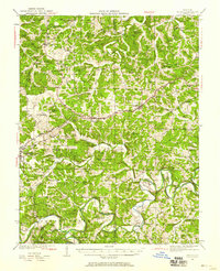
1941 Map of Gerald
USGS Topo · Published 1958About this map
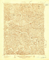
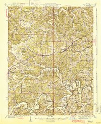
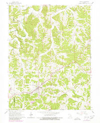
The Chicago Rock Island and Pacific railroad forms the central spine of this mid-century landscape, connecting the growing settlements of Gerald, Rosebud, and Owensville. While these rail towns show signs of development, the surrounding countryside remains deeply rooted in a network of small schoolhouses and country churches. Dozens of locally named landmarks such as Drake Sch, Wiedemann Sch, and Japan Sch are scattered across the terrain, serving as vital nodes for the rural community. To the south, the winding course of the Bourbeuse River carves distinct features into the earth, including the sharp oxbows at Bartel Bend and Kampschroeder Bend. This 1941 survey, published later in 1958, provides a clear view of the area's transition from a strictly river-oriented economy to one defined by the rails and early highway routes like Pacific road.
Find a feature on this map
77 named features on this map. Tap any name to fly to it.
Don’t see what you’re looking for? This feature index may not catch every label — zoom into the map to look around manually.
Map Details
Editions of this 1941 Gerald Map
This is the sole edition of this map. No revisions or reprints were ever made.
Historical Maps of Owensville Through Time
8 maps found