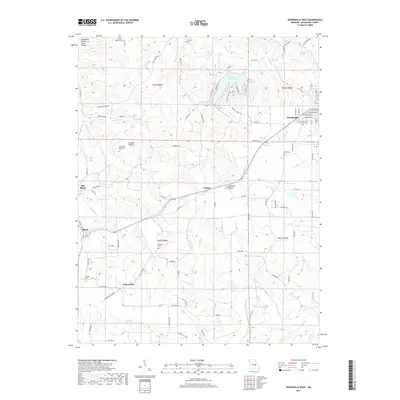
2017 Map of Owensville West
USGS Topo · Published 2017About this map
Owensville serves as a primary hub of Gasconade County, showing a transition from the grid-aligned streetscape of town toward the winding hollows and ridges of the surrounding countryside. The landscape is marked by a deep genealogical footprint, featuring several family and community burial grounds such as Richardson Cem, Branson Cem, and the Old United Methodist Cem located near Douglas Hollow. The terrain is defined by its water systems, where Clear Fork and Sulphur Br feed into the northern drainage, while Peaceful Valley Lake provides a recreational center amidst the rural topography. Smaller clusters like Canaan and Cleavesville reflect the established settlement patterns of the Missouri interior, anchored by crossroads and historical cemetery sites such as the Howard Cem and Catholic Cem.
Find a feature on this map
94 named features on this map. Tap any name to fly to it.
Don’t see what you’re looking for? This feature index may not catch every label — zoom into the map to look around manually.
Map Details
Editions of this 2017 Owensville West Map
This is the sole edition of this map. No revisions or reprints were ever made.
Other maps of this area

1903 · Sullivan
USGS Topo · 1:125,000

1934 · Bland
USGS Topo · 1:62,500

1934 · Redbird
USGS Topo · 1:62,500

1935 · Gerald
USGS Topo · 1:48,000

1937 · Bland
USGS Topo · 1:62,500

1938 · Redbird
USGS Topo · 1:62,500

1941 · Gerald
USGS Topo · 1:62,500

1944 · Gerald
USGS Topo · 1:62,500

1948 · Oak Hill
USGS Topo · 1:24,000

1949 · Saint Louis
USGS Topo · 1:250,000