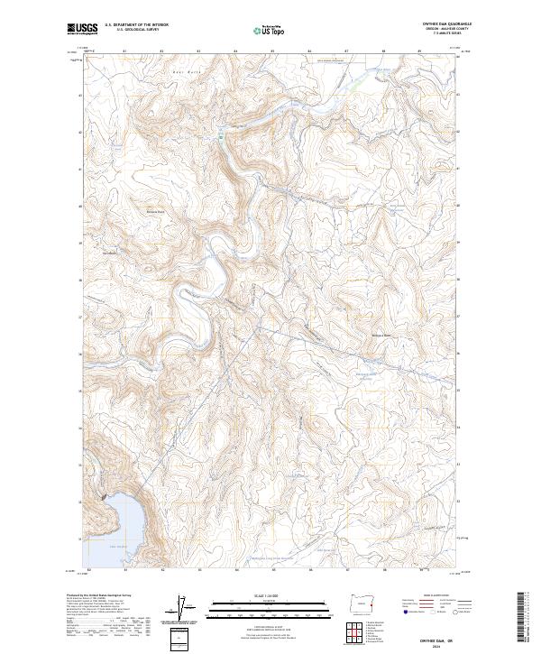
2024 Map of Owyhee Dam
USGS Topo · Published 2024About this map
The Owyhee River carves a deep path through Malheur County, anchored by the massive water management infrastructure that defines this landscape. This 2024 survey captures the intricate network of water transport systems including the Owyhee Siphon, Snively Siphon, and Black Willow Siphon, which serve the high desert agricultural interests via the South Canal and Kingman Lateral.
Find a feature on this map
39 named features on this map. Tap any name to fly to it.
Don’t see what you’re looking for? This feature index may not catch every label — zoom into the map to look around manually.
Map Details
Editions of this 2024 Owyhee Dam Map
This is the sole edition of this map. No revisions or reprints were ever made.
Other maps of this area

1906 · Mitchell Butte
USGS Topo · 1:125,000

1955 · Boise
USGS Topo · 1:250,000

1958 · Boise
USGS Topo · 1:250,000

1962 · Boise
USGS Topo · 1:250,000
1967 · Graveyard Point
USGS Topo · 1:24,000
1967 · Owyhee Dam
USGS Topo · 1:24,000
1967 · The Elbow
USGS Topo · 1:24,000
1967 · Double Mtn
USGS Topo · 1:24,000
1967 · Adrian
USGS Topo · 1:24,000
1967 · Owyhee
USGS Topo · 1:24,000