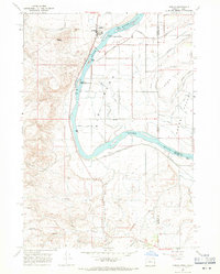
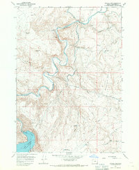
1967 Map of Adrian
USGS Topo · Published 1971About this map
The Snake River carves a sharp path through this 1967 survey of the borderlands between Oregon and Idaho. The settlement of Adrian serves as a focal point, supported by the Union Pacific railroad and a dense network of irrigation infrastructure designed to reclaim the arid landscape. Numerous named drains and canals, such as the Arena Canal, Riverside Canal, and Singer Drain, lattice the terrain of Deer Flat, illustrating the complex water management required for agriculture in the high desert.
Find a feature on this map
53 named features on this map. Tap any name to fly to it.
Don’t see what you’re looking for? This feature index may not catch every label — zoom into the map to look around manually.
Map Details
Editions of this 1967 Adrian Map
2 editions found
Other maps of this area

1898 · Nampa
USGS Topo · 1:125,000

1906 · Mitchell Butte
USGS Topo · 1:125,000

1955 · Boise
USGS Topo · 1:250,000

1957 · Wilder
USGS Topo · 1:24,000

1958 · Boise
USGS Topo · 1:250,000

1958 · Homedale
USGS Topo · 1:24,000

1962 · Boise
USGS Topo · 1:250,000
1965 · Parma
USGS Topo · 1:24,000
1967 · Graveyard Point
USGS Topo · 1:24,000
1967 · Owyhee Dam
USGS Topo · 1:24,000