1967 Map of Adrian
USGS Topo · Published 1981About this map
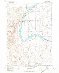
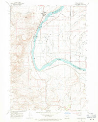
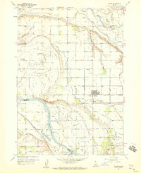
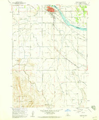
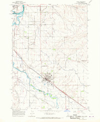
The Snake River carves a sharp, dramatic bend through this 1967 survey of the Oregon-Idaho borderlands, anchoring a landscape defined by sophisticated hydraulic engineering. The small settlement of Adrian serves as a local hub near the river's edge, supported by the Union Pacific railroad and the Adrian Airfield. This arid region was transformed into an agricultural corridor through an extensive network of irrigation features, including the Riverside Canal, the Kingman Lateral, and various named drainage systems like the Alkali Drain and Welch Drain.
Find a feature on this map
57 named features on this map. Tap any name to fly to it.
Don’t see what you’re looking for? This feature index may not catch every label — zoom into the map to look around manually.
Map Details
Editions of this 1967 Adrian Map
2 editions found
Other maps of this area

1898 · Nampa
USGS Topo · 1:125,000

1906 · Mitchell Butte
USGS Topo · 1:125,000

1955 · Boise
USGS Topo · 1:250,000
1957 · Wilder
USGS Topo · 1:24,000

1958 · Boise
USGS Topo · 1:250,000
1958 · Homedale
USGS Topo · 1:24,000

1962 · Boise
USGS Topo · 1:250,000
1965 · Parma
USGS Topo · 1:24,000
1967 · Graveyard Point
USGS Topo · 1:24,000
1967 · Owyhee Dam
USGS Topo · 1:24,000