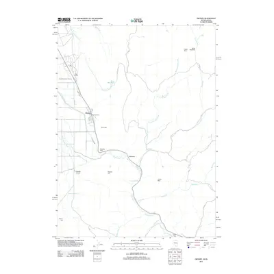
2012 Map of Owyhee
USGS Topo · Published 2012About this map
Owyhee serves as a primary settlement in this high-desert landscape, situated where the Owyhee River meets an engineered water system including the Agency Canal. For genealogists, the map identifies local burial sites at the George Washington Cemetery and the New Cemetery northwest of the main town site. The area's hydrology is defined by numerous seasonal drainages like Skull Creek and Reed Creek, which cut through a terrain marked by distinctive volcanic and topographical features such as The Crater and Yellow Rock. Evidence of rural infrastructure and early ranching history appears through family-named landmarks like Willis Meadows and Prentice Hill, as well as the remote settlement of Ottawanah located further east along the riverbank. This documentation of the Great Basin borderlands captures a balance of native landscape and human modification through water management and established trails.
Find a feature on this map
30 named features on this map. Tap any name to fly to it.
Don’t see what you’re looking for? This feature index may not catch every label — zoom into the map to look around manually.
Map Details
Editions of this 2012 Owyhee Map
This is the sole edition of this map. No revisions or reprints were ever made.
Other maps of this area

1936 · Mountain City
USGS Topo · 1:62,500

1939 · Owyhee
USGS Topo · 1:62,500

1940 · Mountain City
USGS Topo · 1:62,500

1942 · Owyhee
USGS Topo · 1:62,500

1955 · McDermitt
USGS Topo · 1:250,000

1955 · Jordan Valley
USGS Topo · 1:250,000

1955 · Twin Falls
USGS Topo · 1:250,000

1955 · Wells
USGS Topo · 1:250,000

1957 · Jordan Valley
USGS Topo · 1:250,000

1958 · Wells
USGS Topo · 1:250,000