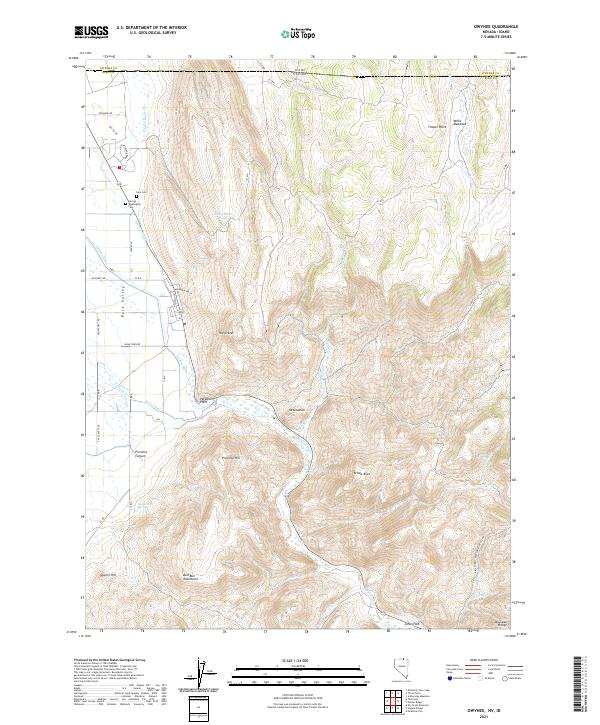
2021 Map of Owyhee
USGS Topo · Published 2021About this map
Duck Valley and the northern borderlands of Elko County define this high-desert landscape where the Owyhee River enters Nevada from Idaho. The 2021 topography reveals a complex network of water management, including the Main Canal, Agency Canal, and the drainage of Thacker Slough, which support the high-altitude agriculture of the region. Local history and genealogy are anchored by specific landmarks such as the George Washington Cem and New Cem, located near the northern edge of the quadrangle. Distinctive terrain features like The Crater, Yellow Rock, and Prentice Hill break the basin floor, while names like Ottawanah and Paradise Point mark the limited points of habitation. The Bull Run Mountains rise in the south, providing a stark backdrop to the flat expanses of Jones Flat and the surrounding sagebrush plains.
Find a feature on this map
61 named features on this map. Tap any name to fly to it.
Don’t see what you’re looking for? This feature index may not catch every label — zoom into the map to look around manually.
Map Details
Editions of this 2021 Owyhee Map
This is the sole edition of this map. No revisions or reprints were ever made.
Other maps of this area

1936 · Mountain City
USGS Topo · 1:62,500

1939 · Owyhee
USGS Topo · 1:62,500

1940 · Mountain City
USGS Topo · 1:62,500

1942 · Owyhee
USGS Topo · 1:62,500

1955 · McDermitt
USGS Topo · 1:250,000

1955 · Jordan Valley
USGS Topo · 1:250,000

1955 · Twin Falls
USGS Topo · 1:250,000

1955 · Wells
USGS Topo · 1:250,000

1957 · Jordan Valley
USGS Topo · 1:250,000

1958 · Wells
USGS Topo · 1:250,000